The Ancient Footpaths That Are Still Telling Hikers, Highways, and Park Rangers Where to Go
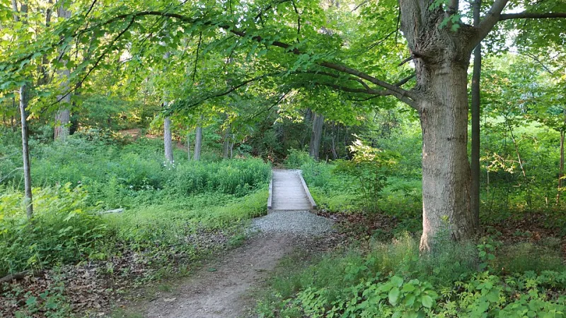
Photo: Thomas Metaxas, CC BY-SA 4.0, via Wikimedia Commons
The next time you're hiking a well-worn trail through a national park, notice something: the path almost always finds the easiest grade up a ridge, the shallowest crossing of a creek, the most sheltered route through exposed terrain. You might assume that's just how trails work — that people naturally converge on the same sensible routes over time.
You'd be half right. People did converge on those routes. But the people who first identified them, tested them, maintained them, and passed down knowledge of them were walking those paths centuries before the first European settler set foot on the continent. And in many cases, the trail you're following today is, in the most literal sense, the same trail.
The Infrastructure Nobody Credited
Indigenous peoples across North America developed one of the most extensive and sophisticated land navigation systems in human history. The network of foot trails maintained by various nations covered hundreds of thousands of miles — connecting communities, enabling trade, facilitating seasonal movement between hunting grounds and agricultural land, and encoding generations of ecological knowledge about terrain, water sources, and safe passage.
These weren't casual footpaths worn down by wandering. They were maintained infrastructure. Trails were cleared, marked, and in some cases deliberately routed to avoid flood-prone areas, unstable ground, or exposed ridgelines where weather turned dangerous. The Cherokee Nation alone maintained a trail network across the southern Appalachians that functioned, in effect, as a regional highway system.
When European settlers arrived and began moving inland, they did what any sensible newcomer does in unfamiliar terrain: they followed the paths that were already there. The trails worked. They went where people needed to go. The settlers used them, widened them, and eventually, as the country industrialized, paved over them.
From Footpath to Highway
This is where the story gets specific enough to be genuinely startling.
Boston's famously chaotic street grid — the one that confounds every GPS system and makes urban planners groan — follows, in significant part, the original Shawmut Peninsula trail network used by the Massachusett people. The winding paths that connected water sources, high ground, and natural clearings became the roads that became the streets that became one of the most densely built urban environments in America.
Broadway in New York City — the diagonal slash that cuts against the city's otherwise orderly grid — traces the Wickquasgeck Trail, a major Indigenous route running the length of Manhattan. The trail predates the Dutch settlement of New Amsterdam by an unknown but certainly substantial number of generations.
In the Midwest, the Iroquois Trail running across upstate New York became the primary route for westward expansion, eventually forming the basis for U.S. Route 20 — still one of the longest roads in the country. The Erie Canal followed similar logic. So did significant stretches of what became the National Road.
The pattern repeats across the continent because it had to. The trails existed where travel was possible. Everything built afterward followed the same physical logic the trails had already worked out.
The Parks Know, Even If the Signs Don't Say So
In the national park system, the overlap is equally striking — and equally unacknowledged.
Land managers and trail planners working in older parks have quietly noted for decades that the most heavily used, most logistically efficient trail corridors tend to align with documented or suspected Indigenous routes. The Great Smoky Mountains, Shenandoah, Olympic, and Glacier national parks all contain trail systems that follow pre-contact paths to a degree that researchers are still mapping.
Some of this is being formally documented now. The National Park Service has been working, slowly and unevenly, to acknowledge Indigenous land use histories in interpretive materials. A handful of trails have been officially renamed or had their histories updated to reflect their actual origins. But the majority of trail signs still describe the routes as if they materialized from the landscape itself — the product of erosion, animal movement, or the instincts of early European explorers.
The animal movement explanation is particularly persistent and particularly misleading. Yes, some early trails followed game paths. But game paths don't navigate around seasonal flood zones. They don't maintain consistent grade changes to minimize energy expenditure across long distances. They don't converge on river fords at the precise points where crossing is safest in spring melt. Those decisions reflect human intelligence and accumulated knowledge, not deer behavior.
What Gets Lost When Credit Gets Lost
This isn't just a historical footnote. The erasure of Indigenous trail knowledge from the official story of American geography has real consequences.
When the origins of a trail network are attributed to nature or accident rather than human engineering, the knowledge systems that produced that engineering become invisible. The generations of careful land observation — knowing which routes held up in wet years, which crossings silted over, which ridgelines turned dangerous in ice — get stripped of their source. The knowledge survives in the landscape. The people who created it get written out.
Some tribal nations are actively working to reclaim this history, partnering with universities, hiking organizations, and land management agencies to document trail networks and restore attribution. The Potawatomi, the Haudenosaunee Confederacy, and several Pacific Northwest nations have ongoing projects mapping the relationship between their historical trail systems and current infrastructure.
For hikers, the takeaway is simpler, and maybe more affecting than any policy discussion.
The path that feels right — the one that hugs the hillside at exactly the right angle, that crosses the stream where the rocks are just stable enough, that opens onto the view you didn't know was coming — has been carrying people to that exact spot for longer than the country you're standing in has existed. Someone figured it out. Someone maintained it. Someone passed down the knowledge of it.
You're not the first one here. Not even close.